Agile Monitoring to Face the Challenges of a Changing World
There is no debate anymore regarding the increase of landslides in the Alps caused by global warming and thawing permafrost. While a large set of technologies are available to measure landslides, none can cope with a rapid increase of cases impacting the local economy, from road infrastructure to the hydropower industry, buildings, and tourism-related infrastructures.
As the person in charge (mayor of the municipality, natural hazard officer, road maintenance officer), you can quickly monitor any site with a potential hazard, therefore addressing possible liability issues related to your function. You also use your resources more efficiently by restricting the intervention of external experts only to the cases where significant land movement is measured or if a rapid increase of the movement is detected, for instance following precipitations. The interaction with the external experts is facilitated by the fact that you are in possession of relevant data about the case considered.
A Versatile Solution
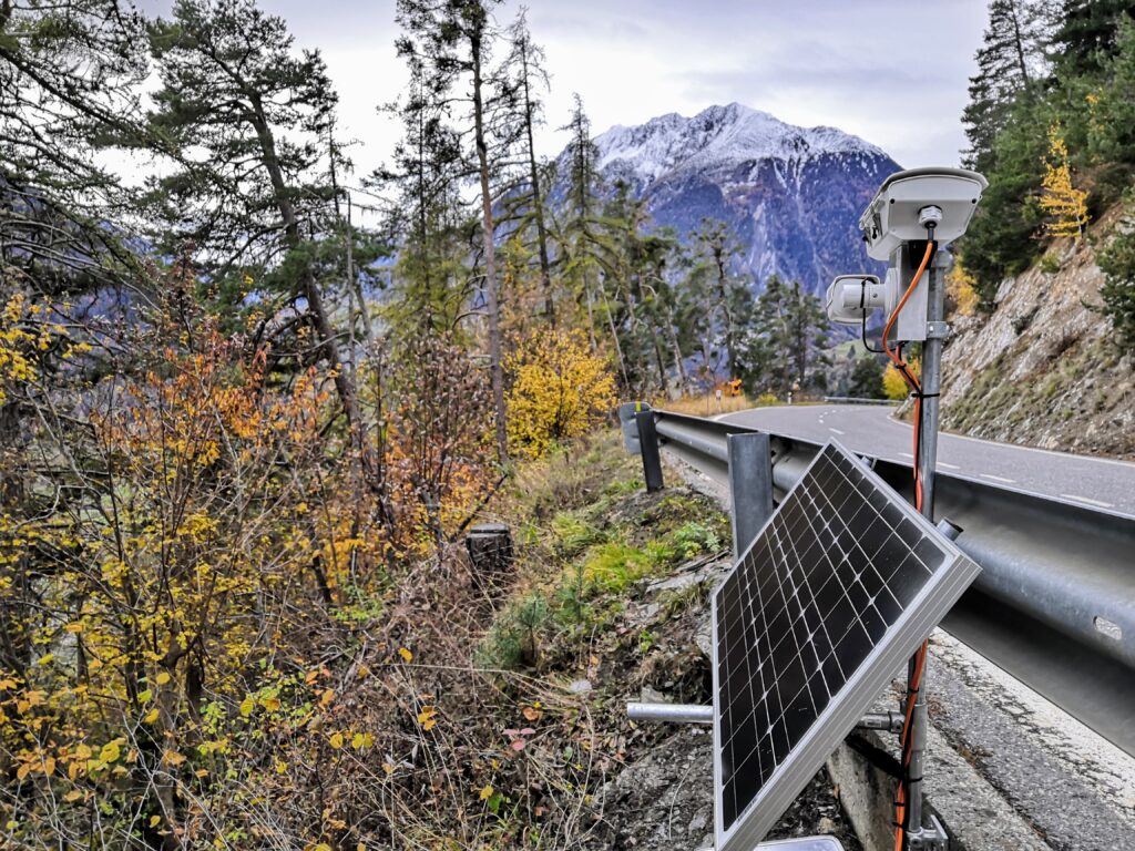
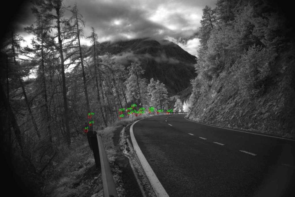
We developed an image processing technology able to measure the displacement of structures (pipes, roads, pylons, buildings) and landslides with unprecedented accuracy. With the large bandwidth of our measurements (from 20Hz to years of measurement), we advantageously complement those of land surveyors to provide the velocity of the landslide or the interaction between operations (construction work, traffic, pipe exploitation, etc..) and land movement.
We can also monitor critical aspects such as seasonal variations and correlate terrain displacement with precipitation and weather events.
Empowering Local Actors
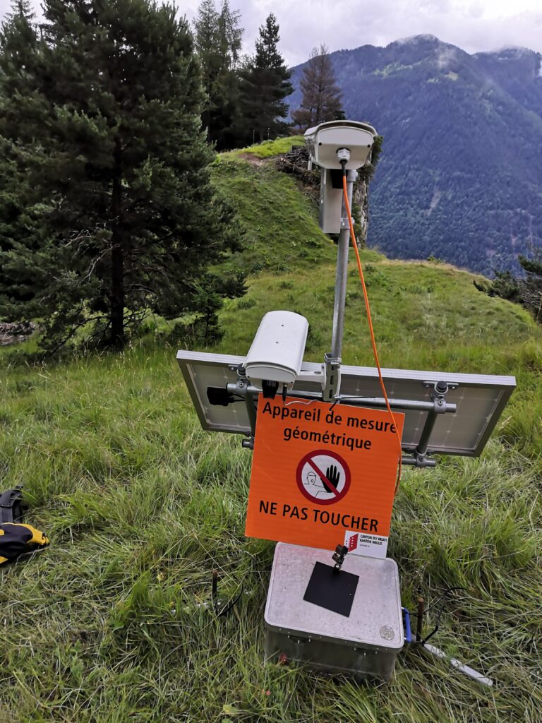
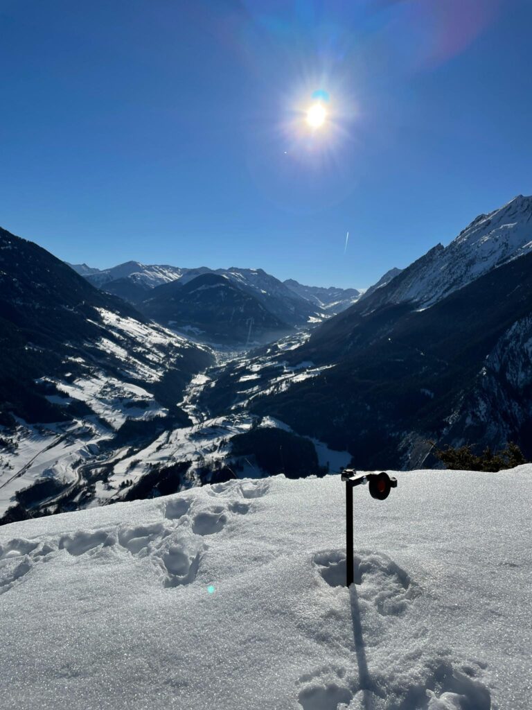
Our autonomous monitoring system can be deployed directly by field practitioners (technicians of utility or cable car companies, forest engineers, and road maintenance personnel). This ensures an efficient deployment by local actors with knowledge of the local terrain and conditions, but for whom traditional monitoring systems are out of reach due to cost or complexity.
Lightweight and Cyber-safe
The displacement monitoring system can be launched in one hour, saving time to set up complex monitoring projects with engineering companies.
The system is undemanding in downstream bandwidth while offering consolidated actionable information such as whether motion is detected or not.
Open Data
Data is exported to the